Σάμος – North-East Aegean
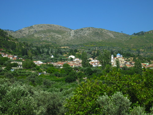
Samos is one of the best and most varied islands for walking in Greece. Its green and pleasant landscapes provides both scenic and easy walks for those wishing a more relaxed holiday. Others might find what they are aiming for high up in the various dramatic mountain ranges. Unfortunately the island has received lots of forest fire damage the last ten years, but you should not let that prevent you from visiting.
The island is a major and slightly up-market package tourist destination, but still idyllic and almost deserted beaches exist, at least out of high season. Some are well within walking distance from the nearest bus stop. Very pretty hill villages will let you sample some excellent local food and drink. Samos is also an island for some traditional sightseeing. Several decent museums and places of archaeological interest can be found. The giant Kouros in the Archaeological Museum of Samos Town is particularly impressive. You should also visit e.g the Heraion and the Evpalinus tunnel. However, that last sight is best suited for the “small and narrow”. Also try to come at opening (08.45 theoretically) to beat the tourist buses that will start appearing around 09.30.
Samos is a producer of good wine and some very decent brandies. The excellent and famous sweet muscat wines are mostly found in the stores, but can also be sampled in the tiny hill villages. I even saw locally grown “mountain” tea! Always available at eateries are the nice dry white “Samaina” and the top of the range “Samena Golden”, which is even nicer. As well as Samos Retsina, of course, which is also good. The problem is just where to go to match these good wines with some food.
If you are staying in Pythagorion, one of the most well known towns and one which has become rather hopelessly “touristy” lately, try the far eastern end of the bay where the beach starts (especially good are Poseidonas and the really excellent and classy Remataki), or the little square by the Town Hall (ta Platania under the trees and Symposium which has fantastic service).
In Samos Town good, simple tavernas are e.g Apovrado in the tourist lane one street behind the harbour, and Gregory’s not far from the OTE offices, just stroll up Odos Smyrnis. Christos was also a pleasant spot ten years ago, by the little square and the church. I have not tried them lately though. Taverna Garden is also pleasant, with very good food, but looks extremely artificial and “touristy”.
If you would like a nice and low priced pension with a bit of personality in Samos Town, I can recommend the immaculate Pension Trova (26. Kalomiris, signposted two streets back from the eastern part of the waterfront). If you visit, please say hi (and thanks) to Maria for me! Hardly a day went by without this nice lady inviting me in for a cup of Greek coffee (or more). For a higher class stay the very good Hotel Samos is a treat. In Pythagorion I don’t really know, there are lots of pretty places in the back streets. At the waterfront it must be way too noisy at night. I tend to go for something very simple and really hidden away here, where I can hear neither traffic nor bars. Pantazis (vis-á-vis Hotel Evripili) I think is some of the cheapest “rooms to et” (sic) in town, and you at least get what you pay for…
I have been lucky enough to receive a full report on the island from Christopher and Anne, continue your reading in Our Holiday in Samos.
Selected walks:
For walks, see Landscapes of Samos by Brian and Eileen Anderson, Samos Patmos Northern Dodecanese by Dieter Graf and Trekking in Greece by Marc Dubin (now out of print). References are made these books as “/Anderson/”, “/Graf/” and “/Dubin/” respectively, and PLEASE NOTE: the walk numbers referred to below are those from the 5th edition of /Anderson/. There is also a booklet by Lance Chilton called Walks in the Kokkari Area of Samos. On the web visit Samos Holiday and Travel Guides, Walks and Photos by Foxy’s Island Walks.
Samos has much to offer any walker at any level, but take care not to overestimate your energies. If you want more challenging walks than the ones I have picked (and tried) below, there are other (but less accessible) walks that should meet your demands. But they are probably unsuitable for most people in the heat of high summer. Two dramatic mountain ranges dominate Samos: The Ambelos, which has walks to the two highest summits at Profitis Ilias and Lazarus, and Kerkis, where you can struggle to the top of Vigla, the highest mountain on Samos (1440m). I preferred to just skirt these ranges myself. If you should insist on something like Vigla (the toughest walk on Samos), you must bring extra food, extra clothes, extra extra water and a compass!
Equipment lists and ratings of the walks can be found in the guide books.
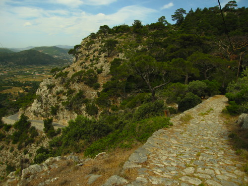
•1 SAMOS – AG. ZONI – ZOODOCHOU PIGIS – SAMOS (my total time 4h32, this includes stops for photography and drinking; +-640m; 2 laps): This is /Anderson/’s “Walk 7” (See also /Dubin/’s “NORTH-EAST LOOP”, and walk 1a in /Graf/). You can make it longer or shorter by including or excluding some of the destinations described. It is a pretty easy walk that is a nice appetizer for more demanding stuff later. It is easy to find and follow the route described in the book.
The kalderimi above Samos Town is mostly in good shape still (June 2008), 10 years after my first visit, but near the top some immense construction site has dug into its foundations and it has started to give. I am not sure how long it will last, but it seems inevitable that this section will slide out and be destroyed pretty soon. YOU BASTARDS!!!
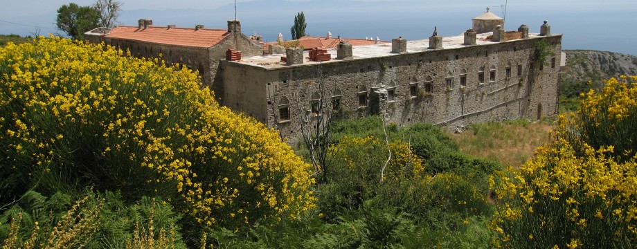
At my latest visit also most of the track by the side of Ag. Zoni was dug up to become like a huge ditch, as part of the refurbishment of the monastery. Also be aware that there is a tiny crossroads just after Kamara that is not drawn on the map. This is NOT the turnoff for Mourtia…
Sadly, a formerly nice picnic spot (on top of the steps after crossing the road towards Z. Pigis) is in a messy state. A fallen tree crushed parts of the ceiling more than ten years ago and now the spring is also dry.
On your way back from Z. Pigis a variation/short-cut can be done. After the (former) spring when you meet the road, do not go left down on the kalderimi again, instead continue following the road until just before the big left turn. Here a wide, rough earthen track goes north. It is even signed for walkers. If you have no specific need to see Kamara again in more detail you can use this track to connect with the main route again just above that small settlement. The map tracing in /Anderson/ is slightly strange, but you can still clearly see this possibility. When you reach a junction with one of the alternatives for walk 6, you go left and then right when you reach the walk 7 main route.
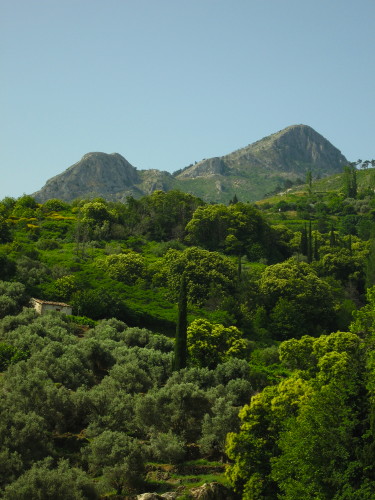
•2 KOKKARI – VOURLIOTES – MANOLATES – STAVRINIDES – AG. KONSTANTINOS (my total time 5h54, this includes a 45 min lunch at a hill village of choice and stops for photography and drinking; +-870m; 2 laps): This is basically /Anderson/’s “Walk 2” (See also /Dubin/’s “NORTH-CENTRAL VILLAGES”).
Because of forest fire damage the formerly very nice and good path from Kokkari to Vourliotes is now somewhat in shambles. After the 20min point, “as the track goes left”, disregard the instructions in the book. Just follow the marked route ahead. Do this also at other places where you might be in doubt. At the 52min point do NOT go left, just go a few meters RIGHT to pick up the marked path again to short-cut the track.
Strangely, up to the otherwise peaceful Manolates, on the extremely narrow, steep concrete street I this time encountered some stupid tourists riding very effective mobile noise pollution units. Incredible what some people absolutely must do to destroy any harmony they can find.
From Manolates towards Stavrinides the lower route is on track, so this time around I selected a higher route (actually from “Walk 5”), where there are surviving paths. There are very detailed instructions in the book for this part of the walk, and you should read those CAREFULLY. For the last dirt road part towards Stavrinides you ARE actually supposed to (as the book says!) go slightly back towards Manolates at a major crossroads. Otherwise you will miss the nice path entrance to the village from below. You can just stroll ahead on the road too, it will lead to the village from above, I am pretty sure I went that way on my first visit here. At that time I came from below, but could see no path. Now the path is well maintained and marked! This very last part is still the same route as described in /Dubin/ at this point.
Surprisingly the formerly rather overgrown path from Stavrinides to Ag. Konstantinos were also in excellent shape and well signposted. For the last couple of hundred meters can follow a nice kalderimi which forks off to the right, or you can stroll straight down the road (now the main route) to the nearest bus stop.
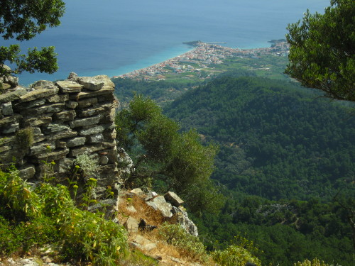
•3 MYTILINI – PLATANAIKA (my total time 5h29, this includes Kastro Louloudes and a small lunch at Vourliotes as well as stops for photography and drinking; +742m -837m; 1 lap): This is /Anderson/’s “Walk 10”. For the most part it is a fairly easy walk in all respects, if you exclude Kastro Louloudes. Except for towards the end, just stroll ahead on the streets, roads and dirt tracks as indicated.
Out of Mytilini be sure to do as the book tells you, to hold right with the street as it curves in direction of Kokkari. BTW, the water tap by Ag. Dimitrios was dry.
At 1h26min I do not understand what they mean, there is nothing on the right here, and as the forest is burnt away you always have full view anyway. Just ahead of you on the right is two small peaks. Incredibly enough, the rightmost of these, and looking by far the most inaccessible, is where Kastro Louloudes is situated.
The approach to Kastro Louloudes is marked by cairns, follow these up to the saddle left of the cliff. CAREFULLY follow the cairns and red blobs around it on the Kokkari side to find the steps to the top. Notice that access to one (misplaced?) red blob has been blocked by branches. This is INTENTIONAL. The correct route starts to descend before going (more steeply) upwards again. BE VERY CAREFUL if you climb the steps to the top. AND BE EVEN MORE EXTREMELY DOUBLE CAREFUL going back down.
When you reach Vourliotes, instead of going left immediately to the square, I suggest you first go right to refill your water bottles at the spring. The taverna by the spring is also very pleasant, and has an incredibly long list of local wine that you can sample, from “glass” (actually 0.25l) upwards.
The instructions after 2h47min seems rather unnecessary. Why it should be useful to NOT enter the path at first (and ONLY signed) opportunity, but to wait until the path again almost coincides with the track maybe two minutes later is beyond me.
Be aware that the “major track” descending in U-bends is not so major anymore. Actually this is now disused and slowly growing over, so be sure to spot cairns guiding your way, turning left from what is now the most major track. At 3h19min turn HARD right and DO NOT cross the river. That happens minutes later.
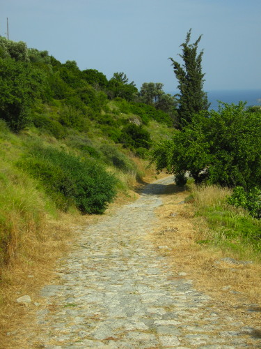
•4 PSILI AMMOS – PALEOKASTRON – VATHI – SAMOS (duration 2h): This is /Anderson/’s “Walk 8 Short Walk”. A very easy walk, suitable for a walk home after the beach. The bus to Psili Ammos only runs in high summer, starting around June 25th. From the beach the path is easy to find. It is also signposted “Metamorphosis” (in Greek), which may be the name of the small church you pass in a few minutes.
After Paleokastron I used the shorter alternative road return. This also might be the best or even only option now that some huge building activities and road constructions is taking place above Vathi. I am not sure how easy it is to follow the main route here anymore (observed but not tested June 2008).
Watch your step on the very narrow pavements down into Samos.
OBS: I did the walk as described above last in 1998. At my latest visit I did the little stroll SAMOS – VATHI – PALEOKASTRON CROSSROAD (+ RETURN) (+-171m; 1 lap; 1h45).
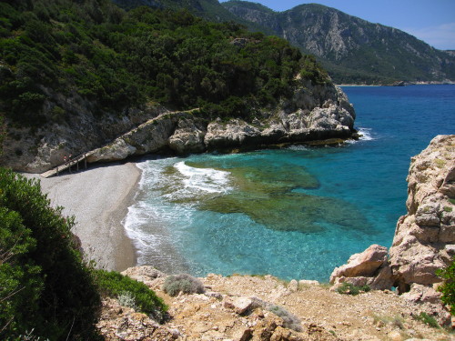
•5 KARLOVASSI – PALEO KARLOVASSI – MIKRO SEITANI – KARLOVASSI (my total time 4h24, this includes about an hour on the beach; +-414m; 3 laps): This is a union of /Anderson/’s “Walk 16 Short walk 4” and “Walk 17 Alternative walk 1”.
Whenever I walk this way I never seem to get further than Mikro Seitani, even though it is a bit stony. Suitable for nudism; and out of high season almost deserted.
A couple of points to note: The timings for the start of the walk is very optimistic as you in the narrow streets of Karlovassi will need to take people and traffic into account. You may meet the bridge in closer to 10 minutes than 5. Be sure to curve (right-ish) with the main street until you see a street sign for the stadium. Then you will also see the bridge. After the bridge “first left” is actually totally correct, however there is no tree. If in doubt you can still follow the main street until it goes left at the next opportunity, where this is a tree, but then you will need to curve back towards the “bend” where you can reconnect with the intended route.
At about 1h02min, where you have gone left and downhill on a minor track, be sure to spot cairns marking the “narrow trail” on your right. You are not supposed to continue on the track.
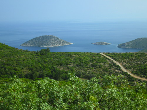
•6 SAMOS – AG. PARASKEVI – SAMOS (my total time 4h16, this includes about an hour on the beach; +-515m; 2 laps): This is /Anderson/’s “Walk 6 Alternative walk 1” (without the Profitis Ilias) + “Walk 6 Alternative walk 3”.
You can put together any combination of the alternatives given in /Anderson/ to make your own favorite. I selected the one described above for getting me as fast as possible to the beach, and for not to do too much of stepping in my own footsteps. A would actually recommend including Profitis Ilias as described in the book, even if I left it out. Beware the partly burnt and partly overgrown path downwards to Ag. Paraskevi. I cannot recommend this anymore. Otherwise there were no problems on this very easy walk.
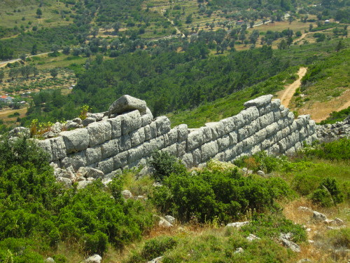
•7 MYTILINI – PYTHAGORION (my total time 3h58, this includes short stops for drinking and photography; +416m -517m; 3 laps): This is /Anderson/’s “Walk 9”. An easy walk. Slight care should be taken towards the end only.
One part of the walk has a description you will probably have difficulties in following. Problems start just after 40mins, when you have turned “right on a concrete track” before a bridge. Be aware the the first “minor track” that you should ignore goes right IMMEDIATELY (actually just an access to a field). After you have forked right you are instructed to “ignore further forks off right”. This INCLUDES even the main track itself when it goes right… The track you are supposed to follow is a minor, slightly overgrown and (at my visit) even chained off track to the left upwards towards the ridge.
Just after the 50min point, there is really just one track remaining, the one you should follow. It too gets very overgrown towards the gully, be sure to spot cairns that will guide you. After the tiny stone bridge, the now completely overgrown path continues along a field.
Before Ag. Triades you can shortcut the road on a clearly visible path. Time for actually visiting the monastery is not included in my timing above.
Some time after the 1h28min point, you “reach another junction less than eight minutes later”. This must refer to this 1h28min point, since it is only like two minutes after the stream bed.
On the steep decent down to Moni Spilianis, pick any of the routes you fancy, just take care not to stray off what is marked. With just a modicum of care it is a fairly easy footpath.
I did not take much time to visit this monastery either, just a quick peek to see the chapel in the cave. From the monastery there is a footpath down to the amphitheatre. You do not need to use the road. After the amphitheatre (which really is nothing great…) you can go right along the road to the Evpalinus tunnel. I included a stroll there and back in my walk, but after seeing the really slow-moving tourists present I could not be bothered… Better savored very early in the morning.
•8 HORA – PYTHAGORION (my total time 5h52, this includes short stops for drinking and photography as well as a dip in the ocean and a visit to the Ireon; +304m -325m; 1 lap): This is /Anderson/’s “Walk 12”. Surprisingly nice for a walk in such flat terrain.
Some time before the 2h12min point, where “the main track forks left downhill”, be aware that tracks are forking both right and left here. And the one going left actually goes uphill (for a few meters). You continue straight ahead.
Shortly after 2h12min, after some tracks have joined from the right, you will have to fork (or continue on the main track…) to the right.
Beware that if you visit the Temple of Hera you CANNOT “walk on to the beach” from there and will have to retrace your steps.
• Good starting points: • Samos Town – can be noisy, but with very good bus connections to most relevant places and some walks directly out of and/or into town, all in all the ideal base camp • Pythagorion – a town now depending 100% on tourism and starts to look more and more like something on the Canary Islands, but with good bus connections and some walks directly out of and/or into town • Kokkari – another tourist resort, but with good bus connections and some walks directly out of and/or into town • Karlovassi – and old industry town and not the nicest of places, but good for exploring the north-west • Votsalakia – a small tourist resort in the south-west, you will need to stay here to do Vigla from the south, the bus connections are not good
• How to get there: • By air • By ferry from some islands • By ferry from the mainland • By hydrofoil from some Dodecanese and North-East Aegean islands
• More info: • Our Holiday in Samos by Christopher and Anne • Samos Island Information – local travel site with also an extensive list of walks • Samos Holiday and Travel Guides, Walks and Photos by Foxy’s Island Walks • Samos Outdoor activities are organizing walking trips on the island
This page was last modified at November 2, 2013.
©1998-2013 .
