Πάπιγκο – Zagoria region in Epirus
If you enjoy nature and walking there are few destinations that can beat Papingo. And/or if you are a fan of the movies of the great Greek director Theo Angelopoulos and would like to visit villages like what can be seen in e.g. his very first movie, up here in the Zagoria is where you can find what you want.
For fans of Greek food the place is also a paradise.
Not for the most easily scared individuals perhaps. You can encounter bears! I did, at least one of them.
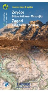
Selected walks: An Anavasi (1:40000) map exist (see above). But I can warmly recommend the “Anavasi mapp”, in other words their “map app”. When I refer to the map (as /Anavasi/), I am using the “mapp” version of Zagori, Tymfi, where you can zoom down to 1:5000. There is even a free version for Zagori Mikro Papigko – Astraka.
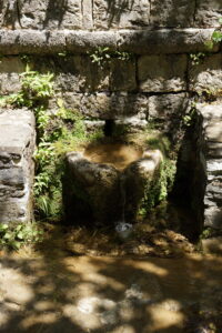
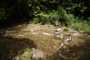
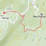 •1 MEGALO PAPINGO – MIKRO PAPINGO ALT.1 (0:59; 3690 steps; 1.99km; alt. gain 174m; alt. loss 136m): This walk uses the most direct route between the villages and avoids all road walking. The upper exit from town (see walkers symbols on the cobbled street going right when you approach the upper parts of town) takes you onto narrow stairs down and a path through the woods. You cross a small creek and eventually a flagstoned path leads down to the main road. Just cross the road where there is a sign for a spring (the spring from the picture above is just meters below). There is also a small wooden sign for Mikro Papingo. Down in the valley you cross the creek at a makeshift wooden bridge. This path is rough, steep and narrow, with countless serpentines. Not my favorite!
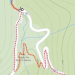 •2 WATER POOLS (0:54; 2780steps; 1.86km; alt. gain 82m; alt. loss 149m): This is my approach to the water pools starting from Mikro Papingo. Stroll down the road to the sign for the shortcut path towards Megalo Papingo (over the pretty stone bridge). You can use this path to avoid a tiny bit of road walking, then turn right on the main road and continue the couple of hundred meters to the entrance of the water pools and turn up left. By all means walk up the gorge as far as it is at all possible to get. Eventually you will have to wade and this is where I turned back. The going is rough but fun, you will have to jump the creek a couple of times and there is a small landslide to negotiated. Turn back when you have had enough. The official part of my walk ends back at the main road. Note that my timings above starts at my hotel and ends back down at the entrance to the water pools by the main road.
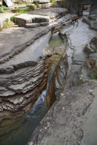
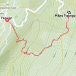 •3 MEGALO PAPINGO – MIKRO PAPINGO ALT.2 (0:55; 3156 steps; 1.97km; alt. gain 180m; alt. loss 137m): This is an alternative (my favorite) way of getting between the villages without any road walking. Well, except for a few meters from the clock tower in Megalo Papingo towards the smaller village, but then after just 20 meters or so you turn down right at a walkers sign. This walk crosses the valley further down than the first walk above, so the height difference is slightly bigger, but the path is much nicer and avoiding so many serpentines it is surprisingly enough both shorter and faster than the seemingly more “direct” route. There is however no bridge so you might get your feet a little bit wet. The are a few stepping stones, or you can just give those the middle finger… In summer there is not a lot of water in the river (see picture above). At two forks (one before and one after the river) you turn LEFT.
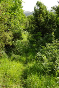
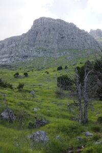
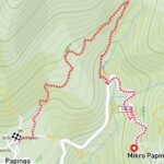 •4 MIKRO PAPINGO – MEGALO PAPINGO (1:04; 4879 steps; 3.05km; alt. gain 107m; alt. loss 156m): This is an adventurous upper route to Megalo Papingo, but it will require some road walking. DO NOT ATTEMPT THIS WALK IN REVERSE. Get yourself to the parking area across the road from the water pools (either via the stone bridge or by just strolling along the road). A narrow path scales the hill above the water pools. This path is fairly rough and overgrown, very stony at points where you walk up a narrow dry creek, very slippery and muddy at other points where water is trickling down a steep hill. At a couple of points the paths sneaks away to the right. Eventually you walk across grassy fields (picture above) and encounter a dirt road that can be followed to the left down to the cobbled street you used in walk 1 above. A fun walk, but due to the difficulties in path finding this walk requires a very detailed map and use of GPS (or it might take you twice as long!). I used the Anavasi “mapp” extensively to confirm just about every step I took.
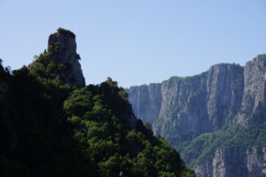
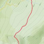 •5 BEAR SPOTTING AND GORGE SPOTTING (2:05; 7493 steps; 4.68km; alt. gain 252m; alt. loss 241m): By doing the walks above you will have approached Mikro Papingo by two different paths from below that both eventually turn into one path. There is also a third path forking off from this just rounding the mountain to a couple of viewpoints over Vikos and the Vikos gorge. From the second viewpoint (approximately an hour from Mikro Papingo) you can still continue on a very narrow path, but this is still uncharted territory for me (and for most/all maps). It looked a bit scary. But maybe not as scary as encountering a bear on my return!!! It ran like crazy up the hill on one of the last scree areas you cross back towards to village. Note that my timings above starts at my hotel and ends at the upper spring in Mikro papingo.
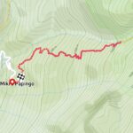 •6 ASTRAKA HALF WAY POINT (2:32; 6353 steps; 5.69km; alt. gain 499m; alt. loss 477m): I can walk far and I can walk steep. But I cannot walk both far and steep at the same time. Half of the Astraka walk was enough for me, it is very strenuous. Start in Mikro Papingo and just continue up up up… Note that my timings above starts at my hotel and ends at the upper spring in Mikro papingo.
• Good starting points • You are already there… • How to get there: • By air (charter) is by far the easiest
This page was last modified at June 17, 2024.
©2024 Harald Haugli.
